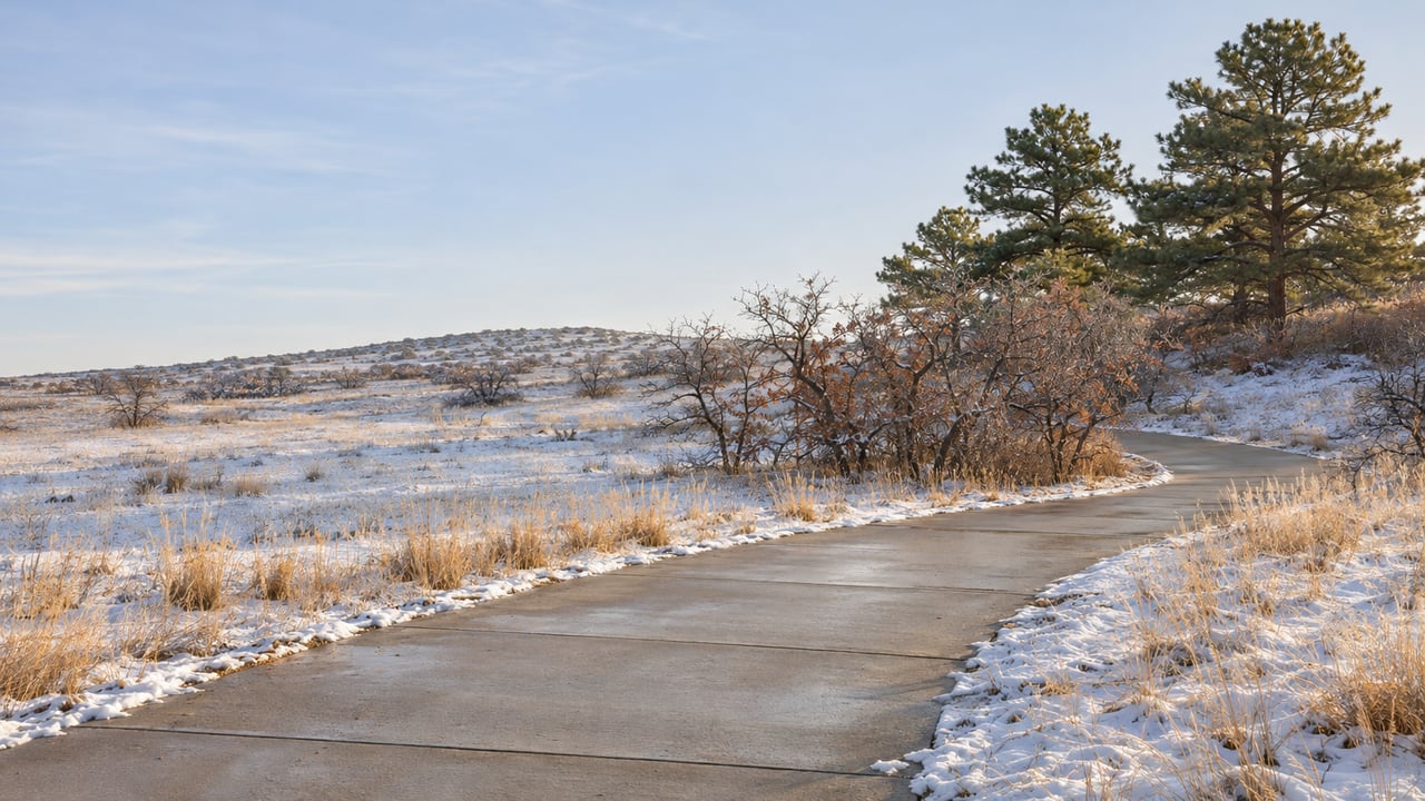
The morning after a snowstorm, two Lone Tree trails can be in completely different shape. On one, a plow has already pushed the snow off the concrete. On the other, the 2.7-mile loop at Bluffs Regional Park still has the storm on it, because nobody plows a dirt trail.
A trail's surface sets that difference. The City of Lone Tree's snow season page says South Suburban Parks and Recreation District, metro districts and HOAs are responsible "for only concrete trails." If you know which local routes are concrete, which are soft surface, and which are a mix, you can pick a winter walk before you even put your boots on.
The order crews clear things in
South Suburban handles snow removal on most trails in Lone Tree. Some trails belong to an HOA or a metro district instead. The district plows whenever it's needed, including nights, weekends and holidays, and its goal is to have snow plowed and ice removed or treated within 24 hours.
The 24 hours runs in a set order. According to the City, the first priority is surface lots and sidewalks at South Suburban facilities, along with routes along or feeding to school properties. After those come routes with commuter trails, then bus stops, then park trails. So a concrete path that leads to a school or carries commuters is likely to clear before a concrete loop inside a neighborhood park. A soft-surface trail isn't on the list at all.
If a concrete trail near you still hasn't been cleared, the City points residents to the South Suburban Service Center at 303-953-7626.
Concrete routes, and the light rail link
The C-470 Bikeway is the clearest concrete option near Park Meadows. TrailLink's listing for the C-470 Bikeway gives its surface as "Concrete."
It became easier to reach in 2025. The City finished its C-470 Trail Connector, which links the C-470 Regional Trail with the County Line and Park Meadows light rail stations and Park Meadows Retail Resort. Douglas County's 2025 year-in-review describes the connector as a 1,900-linear-foot pedestrian and bicycle trail running from the Park Meadows light rail station to the C-470 trail. The City's project page lists it as complete, with work starting in summer 2024.
That gives you a winter walk that starts at a train platform. On a cold Saturday, you can step off the train at Park Meadows and be on the bikeway within that 1,900-foot stretch, with the mall right there if the wind picks up.
Willow Creek is a mix
Willow Creek Trail runs north and south through the middle of Lone Tree. The City lists access points at Cook Creek Park and Prairie Sky Park, the latter at 9381 Crossington Way. To the north it connects to the High Line Canal Trail, and to the south it connects to the East/West Trail. South Suburban's trail map lists it at 6.24 miles, with a 340-foot elevation difference from north to south. Hikers, cyclists, leashed dogs, equestrians and strollers can all use it.
Willow Creek doesn't have one surface. TrailLink's Willow Creek/Greenbelt Trail listing gives it as "Asphalt, Concrete, Crushed Stone." Trail plowing covers concrete, so the concrete stretches are the ones that get cleared. After a storm, a walk along Willow Creek can go from cleared pavement to untouched snow wherever the surface changes. A short out-and-back on a stretch you already know is concrete is the easier choice in the first day or two.
The 340-foot difference matters more in winter. Going south means a steady climb, and coming back north means a steady descent, which you'll feel on a cold morning when the ground is still frosty.
The Bluffs and the East/West Trail stay as they are
Bluffs Regional Park is the trail many people around here picture first, and it's the one that keeps its snow. The City describes it as a 2.7-mile loop of soft-surface trail, starting from the trailhead at 10099 Crooked Stick Trail. Douglas County's page for the park adds about one more mile out to the overlooks and 350 feet of elevation gain. It also says the trail has short, steep sections that can exceed an 8 percent grade. The trailhead has a 60-space lot, restrooms and horse trailer parking.
Those steep sections are where a soft-surface trail feels the weather most, on the way up and on the way down. Since only concrete trails get cleared, the Bluffs loop thaws on the sun's schedule.
The East/West Regional Trail works the same way, over a much longer distance. Douglas County lists it at about 27 miles one way, with 2,070 feet of elevation gain heading east to west and 2,300 feet heading west to east. The County's trail information sheet describes the surface as "Soft surface." The City lists trail connectors at Bluffs Regional Park, Highpoint Council Circle, Willow Creek Trail, RidgeGate Parkway, Schweiger Ranch and Rueter-Hess Reservoir, among others. Parking at the RidgeGate Trailhead and at Bluffs Regional Park comes with restrooms.
The East/West Trail also has a seasonal schedule that has nothing to do with snow. Each year Douglas County posts a detour for Golden Eagle breeding season, closing the affected section from March until around early September. That means late fall and winter are the months when the whole route is open, as long as you're dressed for a soft-surface trail.
Two sets of hours
Short winter days make opening hours matter, and the two agencies set them differently. Douglas County lists Bluffs Regional Park and the East/West Regional Trail as open from one hour before sunrise to one hour after sunset. In late November that means the Bluffs closes in the early evening, not long after the sun goes down behind the foothills.
South Suburban's park and trail rules say its parks, trails and open space are open daily year-round, generally 6 a.m. to 11 p.m. Managers can set temporary hours or close sections for safety, preservation or maintenance. The South Suburban trails, where the concrete gets cleared, also stay open later than the County's. If you only have time for a walk after work in December, a South Suburban trail is open when the County's soft-surface trails are closed.
A new trail on the east side, on a later timeline
The next big addition to Lone Tree's trail network is under construction east of I-25. South Suburban's High Note Regional Park project page says Phase 1 broke ground on April 29, 2026. The phase includes the new Happy Canyon Trail, which links to Schweiger Ranch and the East/West Trail. The park sits along Happy Canyon Creek near I-25 and RidgeGate Parkway. The City's High Note page says it will connect to the rest of the metro area through the nearby RidgeGate Station. The City's 2026 Resident Guide lists RidgeGate Parkway Station at 10791 S. Havana Street, with 1,300 parking spaces.
As Castle Rock News-Press reported, Phase 1 plans also include a 200-seat beer garden, expected to be operated by Lone Tree Brewing Company. South Suburban expects Phase 1 to be finished and open in late summer 2027. For this winter, the Happy Canyon Trail and the beer garden are still on the calendar for later. The routes you can use now are the C-470 Bikeway, Willow Creek, the Bluffs loop and the East/West Trail. For more on how Lone Tree is growing east of the highway, see our Lone Tree and Castle Pines neighborhood page.
Picking a route by the forecast
In the day or two after a storm, stick to concrete. Concrete trails near schools and commuter routes are at the front of South Suburban's list, and the C-470 Bikeway is concrete from end to end. Once a few dry, sunny days have passed, the Bluffs loop and the East/West Trail are worth a look again, with the County's sunset-based hours in mind for the drive home. Willow Creek falls in between. Its concrete stretches get plowed, and the rest of it depends on the weather.
At the Billy Van Heusen Team, we think living a short walk from Willow Creek or the Bluffs is part of what a Lone Tree home is worth. If you're curious what yours would bring this season, request a free home valuation.